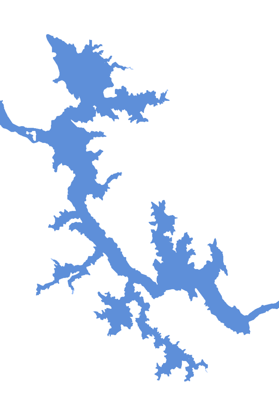
Global Lakes & Reservoirs Repository - GLR

| State | Rifaina-SP/ Sacrament-MG |
|---|---|
| River name | Paraná |
| sub-basin name | Grande |
| Company name | FURNAS |
| Latitude | 20°9'10"S |
| Longitude | 47°16'52"W |
| Construction Period | 1973-1974 |
| Total installed power(MW) | 1040-1050 |
| Destination of Energy | SP |
| Historical Maximum discharge(m3/s) | |
| Mean discharge (m3/s) | |
| Historical minimum discharge (m3/s) | |
| Basin area (km2) | |
| maximum operational water level (m) | 622.5 |
| extreme maximum water level (m) | 626.64 |
| operational water level (m) | 622.5 |
| minimum operational water level (m) | 618.5 |
| Total volume (m3) | 1,418 bilhã |
| Net volume (m3) | 0,178 bilhão |
| Length (km) | |
| Surface area at normal condition (km2) | 46.7 |
| Downstream water level(maximum) (m) | |
| Downstream water level(normal) (m) | |
| Downstream water level(minimum) (m) | |
| Height of the spillway outlet (m) | |
| Height of the main dam (m) | 92 |
| Length of the main dam(m) | 535 |
| Vaciemiento máximo / Capacidad de descarge del vertedor (m3/s) | 13000 |
| Tipo | segmento |
| Número de Compuertas Total | 6 |
| superfície | |
| Base | |
| Largo (m) | 11.5 |
| Altura (m) | 16.5 |
| Cota del tipo de ogiva | |
| Longitud de la cresta (m) | |
| Número de unidades instaladas | |
| Potencial nominal (MW) | |
| Tipo | |
| Ancho Total (m) | |
| Largo Total (m) | |
| Desnível (m) | |
| Referencia | http://www.furnas.com.br/hotsites/sistemafurnas/usina_hidr_luizbarreto.asp |
| Otro información |