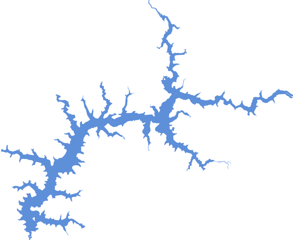
Global Lakes & Reservoirs Repository - GLR

| State | Santa Vitória-MG/São Simão-GO |
|---|---|
| River name | Paraná |
| sub-basin name | Paranaíba |
| Company name | CEMIG |
| Latitude | 19°1'19"S |
| Longitude | 50°29'31"W |
| Construction Period | 1978-1979 |
| Total installed power(MW) | 1710 |
| Destination of Energy | SP |
| Historical Maximum discharge(m3/s) | |
| Mean discharge (m3/s) | |
| Historical minimum discharge (m3/s) | |
| Basin area (km2) | |
| maximum operational water level (m) | |
| extreme maximum water level (m) | |
| operational water level (m) | |
| minimum operational water level (m) | |
| Total volume (m3) | 5,540,000,000 |
| Net volume (m3) | |
| Length (km) | |
| Surface area at normal condition (km2) | |
| Downstream water level(maximum) (m) | |
| Downstream water level(normal) (m) | 397 |
| Downstream water level(minimum) (m) | |
| Height of the spillway outlet (m) | |
| Height of the main dam (m) | 127 |
| Length of the main dam(m) | 3600 |
| Vaciemiento máximo / Capacidad de descarge del vertedor (m3/s) | |
| Tipo | |
| Número de Compuertas Total | |
| superfície | |
| Base | |
| Largo (m) | |
| Altura (m) | |
| Cota del tipo de ogiva | |
| Longitud de la cresta (m) | |
| Número de unidades instaladas | 6 |
| Potencial nominal (MW) | 273 |
| Tipo | Francis |
| Ancho Total (m) | |
| Largo Total (m) | |
| Desnível (m) | |
| Referencia | |
| Otro información | The original design allowed for installation of four more units, but these are not planned in the foreseeable future. |